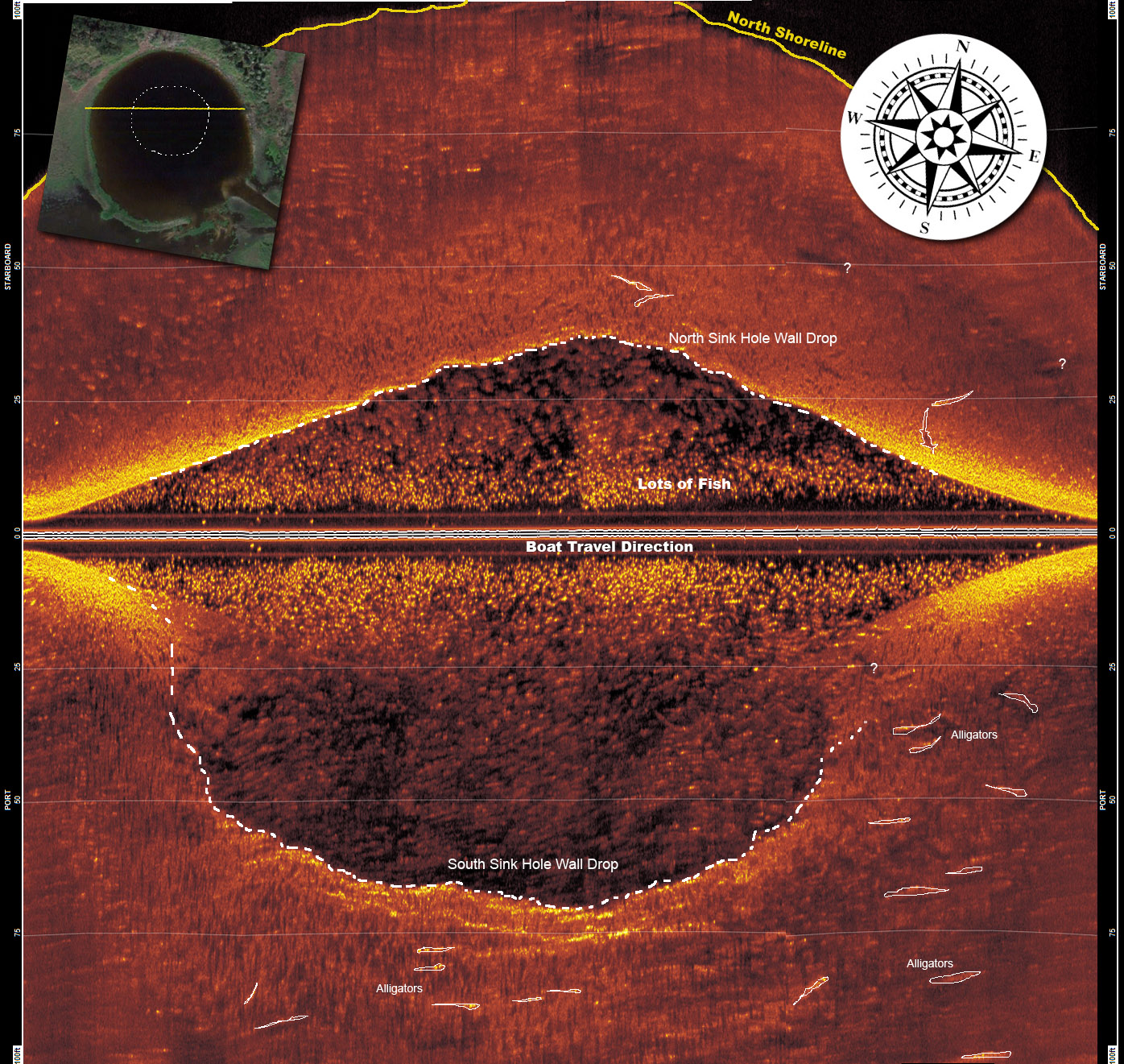
Sonar (SOund, NAvigation and Ranging) is a technique that uses sound waves to detect and locate objects underwater. Side scan sonar is a specific type of sonar used to image the topography of the seafloor.
Side scan sonars transmit a narrow fan-shaped acoustic pulse (ping) perpendicular to its direction of travel. As the acoustic pulse travels outward from the side scan sonar, the seabed and other objects reflect some of the sound energy back in the direction of the sonar (known as backscatter). The travel time of the returned pulse is recorded together with its amplitude as a time series and sent to a topside console for interpretation and display. The topside console stitches together data from successive pulses, creating a long continuous image.
As with any acoustic sonar, side scan sonars only show echoes of objects that reflect sound back to the side scan sonar transducer, such that hard shiny surfaces are sometimes only seen when they are at right angles to the sonar and rough seabed textures can blot out smaller targets completely.
Materials, such as metals, boulders, gravel or recently extruded volcanic rock, are very efficient at reflecting acoustic pulses (high backscatter). Finer sediments like clay and silt, on the other hand, do not reflect sound well (low backscatter). Strong reflectors create strong echoes, while weak reflectors create weaker echoes.
Interpretation of side scan sonar data develops with experience. Side scan sonar reflections of isolated small objects give no indication of shape or attitude. Man made structures, such as platforms or rock walls tend to have regular patterns that are easier to identify.
Using a side scan sonar is rather like looking at a world made of shiny black plastic, in the dark, with only a narrow torch beam for illumination. Remember that when close to large objects, or in a depression in the seabed, that the viewing range of the side scan sonar may be severely limited.
Very strong reflectors may give multiple echoes along a bearing line, and are identified by being equispaced in range. The plan view provided by the side scan sonar also does not show how high an object is, unless an acoustic shadow is cast, in which case the length of the acoustic shadow is related to the height of the object, its range, and the height of the side scan sonar. |